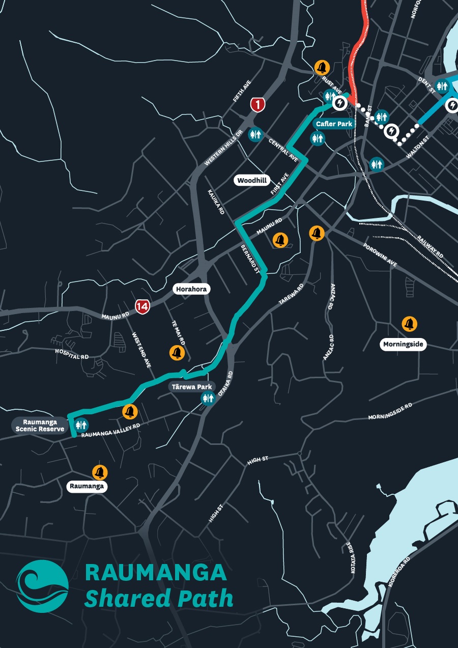
Raumanga Shared Path

Distance: 3km
Time to walk: 45 mins
The Raumanga Shared Path runs about 3km between Raumanga Scenic Reserve and the Whangārei Central Library on Rust Avenue.
It roughly follows the Raumanga Stream before it gets to Maunu Road, then continues through the Avenues, making for a smooth and gentle descent north to the city, or a gentle incline going south.
It provides access to:
- NorthTec
- Whangārei Hospital
- Hora Hora School
- Raumanga Scenic Reserve
- Tarewa Park / the isite
- a skate bowl
- Jubilee Park
- Maunu Road shops
- the central city.
You can find public toilets nearby in Raumanga Scenic Reserve, Tarewa Park (isite), and First Avenue next to Cafler Park.
Download the Raumanga Shared Path map(PDF, 155KB)
Map legend
 Unpaved path
 Suggested walking link
 Toilets
 Schools
 Locky Docks (secure bike parking)
 Kamo Shared Path
 Connections
 Raumanga Shared Path
 Hātea Loop Huarahi o te Whai
 Onerahi Shared Path
Shared paths are especially made for bicycles, walking, pushchairs, skateboards, mobility scooters, wheelchairs and other similar devices.
Motorbikes, cars and other road vehicles are not permitted on shared paths.
Please keep left when using shared paths, maintain a polite speed and distance while passing others, and stay on the pavement.
Location
From Raumanga Valley Road to Rust Avenue, Whangārei 0110
View Map
-35.7336156,174.3098917
From Raumanga Valley Road to Rust Avenue ,
Whangārei 0110
From Raumanga Valley Road to Rust Avenue ,
Whangārei 0110
Raumanga Shared Path