Onerahi Shared Path

Distance: 6km
Time to walk: 1 hr 30 mins
The Onerahi Shared Path starts at Dave Culham Drive (Pohe Island) and runs east alongside Riverside Drive, then onto the start of Old Onerahi Road.
From there, you can easily access Waimahanga Road and Boswell’s Track, a bike-friendly gravel walking track leading to harbour-side shared paths and the southern tip of the Onerahi Peninsula. It is relatively flat, always near sea level and is popular with walkers.
Combining these paths can make for a total length of about 6km.
The path does not reach the top of the hill on Onerahi Road and does not provide direct access to Whangārei Airport or the main Onerahi shops. The suburban roads that lead to these places in Onerahi tend to be quiet but steep.
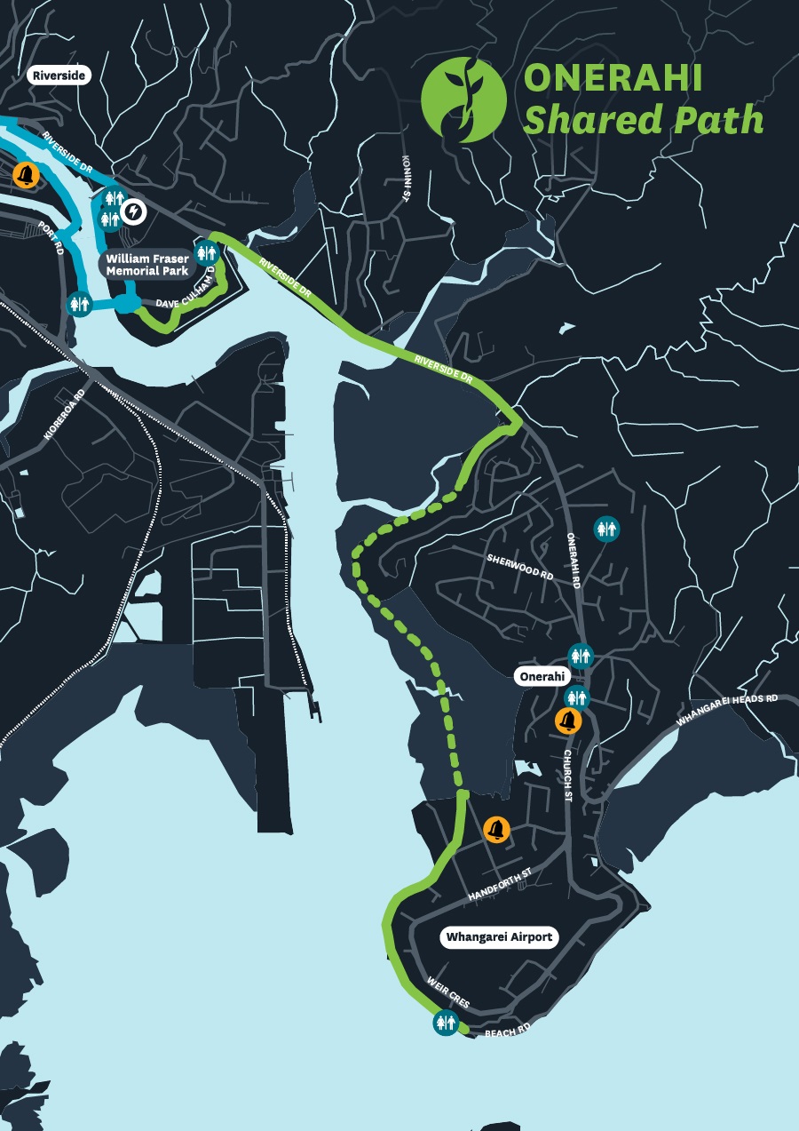
Download the Onerahi Shared Path map(PDF, 167KB)
Map legend
 Unpaved path
 Suggested walking link
 Toilets
 Schools
 Locky Docks (secure bike parking)
 Kamo Shared Path
 Connections
 Raumanga Shared Path
 Hātea Loop Huarahi o te Whai
 Onerahi Shared Path
Shared paths are especially made for bicycles, walking, pushchairs, skateboards, mobility scooters, wheelchairs and other similar devices.
Motorbikes, cars and other road vehicles are not permitted on shared paths.
Please keep left when using shared paths, maintain a polite speed and distance while passing others, and stay on the pavement.
Location
From Dave Culham Drive to the start of Old Onerahi Road, Whangārei 0112
View Map
-35.7311688,174.3434397
From Dave Culham Drive to the start of Old Onerahi Road ,
Whangārei 0112
From Dave Culham Drive to the start of Old Onerahi Road ,
Whangārei 0112
Onerahi Shared Path